Saturday, October 11, 2014

Au Revoir, Méditerranée

After spending almost two weeks waking up to the sunrise over the water, we head north for Paris and parts west--far west.
From our balcony, sunrise over the Mediterranean


Our apartment is just above entrance with green tablecloth


Seaside walk in front of our apartment
Our host (landlord) arrived exactly on time to check the apartment and was most gracious (and discreet) in checking around at our cleaning job--stellar, I might add.  We had spent the early morning cleaning and went for coffee in order to steel ourselves for the day ahead.  The lavarie (laundramat) was closed, so I was unable to wash the draps (sheets) and duvet cover, and M. Rigo seemed unfazed by that though his wife may have more to say about it.  Right around the corner, we have visited a particular brasserie where we enjoyed either coffee or beer depending on the time of day.  We bid adieu to the Madame there, packed the car and carried out the bags of garbage that we Americans accumulate like nobody else.

After saying goodbye to M. Rigo and leaving him with his keys, we hopped into the car making our feeble attempts at showing energy for the day ahead.  We drove north toward Narbonne where the road is often very windy.  Fortunately, even the wind generators were still.  The last time I drove that stretch, I returned home wracked with pain in my arms and shoulders from clutching the wheel.  

The terrain changed from seaside and oyster beds to scrubby hills.  North of Narbonne, we headed toward Millau in the Central Massif where the hills changed to mountains and valleys.
Millau bridge approaching from south

Millau bridge from north side
Constructed 10 years ago, the bridge at Millau is the highest viaduct in the world.  The road bed is 900' above the River Tarn.  It's a magnificent feat of engineeering and construction spanning a deep valley in a way that is both practical and graceful.  It's a wonder to look at.


The skies opened and we were deluged with rain slowing us down and making the driving more challenging.  On the péage (toll road), signs are posted, which show that the normal speed limit is 130 kph.  When it's raining, the speed limit reduces to 110 kph, which means the 8.5-hour trip is stretched into a 9-plus-hour trip.
Speed camera ahead

Mr. Speed Camera--box in center with evil eyes
 I've described the speed cameras before, so you know we slow down whether we want to or not.


As we moved out of the Massif Central to lower hills again, the woods crept up to the road and the trees became skinny and tall the way they are in northern France (because they are constantly harvested).  By the time we passed over the Cher River (which runs through the Loire Valley and, in fact, under my favorite chateau, Chenonceaux), the sky lightened and we saw the sun peek through here and there. After the Cher, the landscape changed to flat long fields far into the distance--a little like the terrain in the agricultural central valley of California.  But different. . .

Closer to Paris, traffic became thicker and unpleasant.  Already tired, we became resolved to our fate of having to drive the périphérique around Paris at rush hour--in the dark--along with many others not wanting to be there any more than I did.  There were no other choices and I found a lane (as far right as possible without being kicked off at whatever the next exit was) where I sat--and I mean "sat," rather than racing smoothly along at my allowed 110 kpm.  We finally dumped onto the A6 toward Charles de Gaulle airport and headed for Senlis where we had hotel reservations.

When we finally pulled into the parking lot of the Hotel IBIS, it was past 8 p.m.  We had left at 10 a.m.  That 8.5-hour drive somehow ballooned to 10 hours.  We checked in, dropped our luggage in the room and had dinner at the hotel--not our first choice. But considering our day, that was the best choice.


Glad to be here.  Well, sort of glad to be here. . . 

Thursday, October 9, 2014

Elne

Southwest from Canet-Plage is the town of Elne.  Like Canet, there's the beach Elne and the town Elne--each separated from the other but joined in municipality and in history.  Elne was the capital of Roussillon in antiquity.
And its cathedral--built in the 11th century stands over the town.
Looking over Roman wall into "new" town
 The cathedral and its neighborhoods are inside the ancient Roman walls with narrow streets--many pedestrianized--and narrow buildings.
Narrow houses in old cité 
Decorative window protection
Narrow pedestrianized street
Through the wall


Its monument to the war dead of WW I and the South Asia and Algerian wars is inside the walls overlooking the new town below.
Maillol sculpture in memoriam to the war dead
As in many other towns, the names of the WW I dead outnumber the others with solid lists on three sides to the one short list on the fourth side including war dead from both of the more recent two.

The cathedral is late Romanesque--large for Romanesque.  It was the religious center of Roussillon from the 6th to the 17th centuries.  When the center changed from Elne to Perpignan, the Bishop up and took the famous relics with him leaving Elne and its cathedral a forgotten backwater.  
Column in cloisters
Beautifully-preserved capitals in the cloisters
The buildings, however, remain, and are full of well-preserved carved capitals in the cloisters and other stone features.
The white blue-veined marble in the cloisters


Elne is also home to La Maternité Suisse (the maternity hospital) that was made famous by the Swiss nurse, Elizabeth Eidenbenz, who took in at least 1000 women and children between 1939 and 1944.  Women fleeing the concentration camps survived the war and gave birth here to 597 children.

A museum dedicated primarily to the work of Etienne Terrus shows their permanent exhibition of his work along with temporary exhibits of other artists.  Terrus was friends with Aristide Maillol (from Banyuls-sur-Mer) and Henri Matisse, among others.

Life here in Roussillon holds endless surprises.  It's not all beaches and sunshine, though it's also beaches and sunshine. The entire time we've been here, this has been the warmest and sunniest part of France except for Corsica.


Tuesday, October 7, 2014

Cathar Country

Not far from Perpignan in the foothills of the Pyrénées Orientales (eastern Pyrénées) are several Cathar ruins perched on remote mountaintops in remote countryside.   The Cathars, a Christian sect, occupied these parts for about 100 years practicing their nonviolent, vegetarian and celibate way of life. They were all the while in a power struggle with the Catholic church in Rome to whose allegiance they did not subscribe.  As a result, the Catholic church gave its support to all who would help to rid the area of those they considered to be heretics.  In the 14th century, the Inquisition combed through these parts and slaughtered and burned tens of thousands of Cathars.

The remains of the Cathar strongholds are impressive examples of both their ability to create sanctuary in a most inhospitable environment and the tenacity of their enemies to root them out.

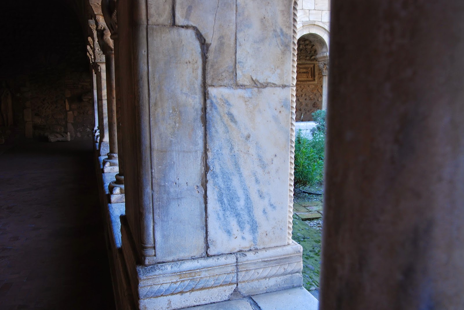
We drive first to Força Réal to see l'Ermitage de Força Réal.
View from Forca Real

Força Réal with sculpture

Built in 1692 as a place of prayer and introspection, it was left in ruins in 1817 after republican soldiers plundered the place.  It was then restored in 1899 and remains today the location for periodic religious celebrations.  From the top, one can see to the Vermeille Coast (where we are staying), l'Etang de Salses (northeast of Canet-Plage) and le Canigou in the massif des Albères.  At this time of year, there are few other visitors allowing us to have a better sense of the peace of the place. While this is not a Cathar ruin, it is in the Cathar country for which this blog is named.

North from Força Réal lies Quéribus.
Queribus from below
Quéribus is the smallest Cathar château and is perched at approximately 728 meters high.   It was built between two valleys where the wind is ferocious and would have made its construction conspicuously difficult and dangerous.  The château looks out over the Roussillon valley, and we can see both Força Réal and Peyrepertuse, another Cathar château.
View of Peyrepertuse from Queribus

When faced with the task of making the climb up to the castle, we opt to commit to the climb at Peyrepertuse as two castles seems formidable.

We move on to Peyrepertuse by snaking back down the mountain through Cucugnan and snaking up another mountain to arrive at the monumental and remarkable château.
Peyrepertuse from below
From a great distance, the limestone spur is discernible, making it all the more impressive up close.  The scale of this castle is oversized.  It is at about 800 meters (about 2600') high, 60 meters wide and 300 meters (just under 1000') long.  Shaped a little like the Queen Mary, it is a monster.

We buy our tickets, gird our loins and start the climb.  Warnings suggest the need for proper footwear (not that I am wearing any) and extra precautions in the wind (for fear of flying over the precipices to certain death).  We need more than girded loins for this climb.  We also need psychological resolve.
The easy part
 Throwing all caution to the wind (no pun intended), we begin our trek down (yes, down) rocky paths littered with roots and mud and here and there a gnarled trunk of a bushy tree blessedly located within grabbing distance for the needed push.  Naturally, we have to go up as well.  And up.  And up.  Mostly climbing on paths that take us both close to the edge and hugging the limestone--the position I prefer.

About half-way there, an English woman passes us going down and cheerily urges us on by saying, "You're almost there."  She is lying.  There is no "almost" to it.  I'm sure her motivation is benevolent.  Phil considers it spiteful--likely from years of eating English boiled meat.
We have reached the bottom of the castle.
Nonetheless, we finally arrive at the chateau itself.  On one end of the spur, there are several men doing construction work.  One stonemason works by himself in a trench shaping and laying large stones.  In other areas in that end, the southeast triangular end, access is denied because of the work.   While we are there, we watch a man build a scaffolding out over the end of the chateau with sheer cliff face below.  It doesn't seem like something OSHA would have approved.  

St. Mary's church
The donjon and St. Mary's church are in the same general structure, which seems an odd juxtaposition of prison and worship.

At the other end of the spur is the staircase about which we had been warned below, the "Stairs of Saint Louis" giving access to San Jordi's chapel.
Looking down the stairs


The staircase comes with a rope "bannister" to assist all but the most confident climb through the howling wind knowing that the consequences of a misstep could be irreparable and what looks like a newly-constructed railing of wood.
At the top of the stairs

At the top of this staircase are a tower, a window and bench and a fireplace in one room, San Jordi's chapel and a view to what seems like the end of the earth. After Força Réal and Quéribus, I thought the view couldn't get any better; and yet, here at Peyrepertuse, I am speechless.
Looking back to the lower part. 

But then we have to descend the same challenging path on the same inappropriate shoes and the same apparent death wish with which we started the climb in the first place.  Phil couldn't help offering his motivational "almost there" to passing climbers.  I can only hope those climbers break the chain of that misdirected encouragement.

These ancient sites were built in impossible conditions and geographically remote areas.  But the most impressive site in toto is Carcassonne, near Toulouse and the greatest of Europe's walled cities.

Carcassonne sits just above the Aude River, and because of its location between the Mediterranean and the Atlantic was a stopping point on the Romans' journeys from Rome and the Iberian Peninsula to parts northwest.  The Romans established the town in the 2nd century B.C. and built the inner walls.

Much later in the 12th century, the town was controlled by Trencavel who built the chateau and the cathedral.  He gave sanctuary to the Cathars in 1209; but they were rooted out by the Inquisition in the 14th century.  In the 13th century, King Louis IX--the only king to have achieved sainthood, built the outer walls.

Carcassonne was restored to close to its current glory in the 19th century.  And glory it is.  As one approaches, the walled city looms out of the land like something out of a fairy tale.  Heavily touristic, it is nonetheless architecturally and historically fascinating.
Approach to Carcassonne


Outside the walls


The moat is grassy and inviting.  The ramparts are complete.
Entrance to Carcassonne
Between the ramparts and the outer wall

On our first visit here, we stayed at Les Remparts hotel, which is inside the walls.  We parked our car on the grass and were allowed to drive in after 6 p.m. when the streets were nearly empty.  Then in the morning we had to drive out before 11 a.m. in order to miss the crowds.  That was my first experience driving along a street narrow enough that the boys could reach out their arms and touch the walls.
Sculpture dedicated to person responsible for restoration

Next tour group entering the portal
Despite the madness of the crowds, Carcassonne is the frosting on the Cathar cake.                                                                                                                                                                                                                                                                                                                                                                                                                                                                                                                                                             

Saturday, October 4, 2014

Roquebrun--Le Petit Nice

We have two weeks in our apartment on the Mediterannean at Canet-Plage.  So each day we look for a new adventure that is within driving distance and promises some discovery.  Not difficult, but always a challenge simply to decide which direction to take.

In an effort to cover a swath of diverse countryside, we started in Narbonne Plage (the beach of Narbonne).  The coast from Canet-Plage north is a series of strips of land bordered on one side with the sea and on the other with marshes or inland lakes.  Narbonne lies inland from the sea though in Roman times, it was a seaport.   The Aude River changed course and the port silted up making the port useless. Nonetheless, it was on the Via Domitia and  was an important Roman city between Rome and Spain.  The coast of Narbonne is now much like the rest of the seaside resorts in this area.  What we discovered was a town with an older village and stretches of newer and some much newer houses and apartments for holiday makers like us.

Climbing up from the sea, we headed into higher countryside  with vineyards and scrubby pines.
Vineyards and pines
View to the Mediterranean
At a vista point, we stopped to look at an orientation table that was atop what looked like a WW II bunker.


Moving on, we passed through Colombier which sits along the Canal du Midi. The lock was just in the process of shepherding a boat from one level to another in time for the next boat to arrive for the same treatment.

Moving on, we passed Capestang where the 9th century tower pushed high up into the sky.
Capestang


Our destination was Roquebrun sitting over the River Orb.  The town is known for its Nice-like microclimate where wine grapes are grown in great profusions.  The town hosts several caves where wine is available for tasting and for sale.  Its major sites are the cactus garden (We took a pass on that coming from cactus-laden California.) and the Carolingian tower from the 10th century.

We stopped for lunch at a restaurant perched on the hillside overlooking the river and bridge.
Overlooking the bridge and Orb River

Kitchen garden
Called "Le Petit Nice" like the town's nickname, it was a perfect place to enjoy the river.  Below the balcony where we sat was a kitchen garden with a profusion of tomato plants and recently-harvested butternut squash sitting along the stone wall near the river and others not yet harvested along the inner wall.  Down the river from the bridge were the remains of an old mill, which in its heyday must have produced flour for the town.
Former mill


Lunch started for me with a kir--white wine with a bit of cassis.
Kir
This was followed with an extraordinary salad of honey-drenched goat cheese toasts over fresh and crispy lettuce and serrano ham.
Salade de miel de chevre
Every morsel was uimaginably delicious.  Phil's plebian pizza was much to his liking along with his crispy beer.  Lunch was followed by coffee and a search for what I thought would be a Roman bridge but which turned out to be nothing of the sort.


Across from the restaurant was a monument honoring the war dead from World Wars I and II and the Algerian conflict.  As always, attention was taken to the floral embellishments.


War monument

Honoring those from conflict with Algeria


We returned to our nest satisfied with our exploration into a present-day world of long ago.


Wednesday, October 1, 2014

Canal du Midi--Canal of Two Seas

The day begins with a sunrise off the balcony giving us a clear sign that this is the day to revisit the Canal du Midi.
Sunrise in Canet-Plage
Heading northeast from Canet-Plage, we take the peage (toll road) until the sign warns us of a "bouchon" right after "Sortie 41" (exit 41).  We must go beyond to exit 38.  Just before the exit lane, it's clear that to stay on the highway would be foolish.  So we exit at 41 and travel the rest of the way to Bezier on a non-toll road.  Looking back at the highway, we agreed the decision was sound.

As we exit the toll both, we see a gaggle of "Douane" (border patrol) checking the traffic as it enters.  While France does not have the police presence we see in the United States, we've noticed more interest on this visit.  And since we're near the border with Spain, it isn't unexpected.

On the southern edge of Bezier and within sight of its cathedral, we veer toward the east and the canal and stop at the Ecluses de Fonserannes, or the Neuf Ecluses.  (Please note there are accents belonging to several of these words including "peage" and "ecluses" but which I cannot seem to figure out on the blog, so for you francophones, please excuse.)
Looking up the locks

The Canal was built during the reign of King Louis XIV in the 17th century and opened for operation in 1681.  Originally called the "Royal Canal," it was changed in 1789 by the Revolutionaries to the Canal du Midi--more proletariat in keeping with their political interests.  It was considered one of the greatest engineering feats of the 17th century and has been in continuous use since then--for commercial purposes as late as the 1970s.  The canal is 360 kilometeres long and drops 620 feet in elevation from Toulouse to the Mediterranean.  There are 69 locks that adjust the height of the water between the Canal de Garonne and the Mediterranean.  The Canal de Garonne flows into the Atlantic connecting the canal from the Mediterranean to the Atlantic.

L'Ecluses de Fonserannes includes seven basins and eight gates and the change in height is astonishing to watch.
Trying to control the boat
A canal boat operated by a couple from Great Britain was in the bottom basin when we arrived.
The crew tying off the boat
He handled the boat, she the rope.  She walked along beside the boat tying up at each level while he tried to control the boat in the basin against the powerful surge of water flowing from the next gate up.
Filling the basin
Then the water levelled off and the upper gate opened and he moved the boat into the next basin while she carried the tether to the next tie-off.

Success despite his self-confessed white knuckles

On the opposite side of the canal, the lock lady shouted instructions and handled the locks.
Lock lady
As spectators, the whole process was fascinating.  As lock lady, I'm not so sure.  She goes from gate to gate shouting instructions and waiting, shouting instructions and waiting the whole day long.

At the top we found a plaque dedicated to Thomas Jefferson honoring him for his friendship and appreciation for France and its riches.
Thomas Jefferson--friend of France
He traveled the full length of the Canal when was in France in the 18th century--a hundred years after it was built.  This plaque is identical to the plaque facing the Mediterranean in Nice that I discovered on our trip in 2012.  I told the woman in the tourist office that it touched my heart.  The inscription is so generous, it even got me choked up a bit.  

After that dramatic view, we moved on to the Pont-Canal de l'Orb--a bridge which carries the Canal du Midi over the Orb River.
Canal du Midi over the Orb River

Standing on the Canal bridge over the Orb River


This bridge was built in 1856.


The Canal is very muddy and full of debris from the recent significant storms in the Herault area of France not far from Beziers.  During our previous trip, the Canal was a whole different color and sat lower on the banks.

Tomorrow promises to be another sunny day.  Perhaps we'll head up into the Pyrenees or pay a visit to Andorra.